OCTOBER
Total Distance: ~ 75km
(Photos - Courtesy of fellow walkers)
(5) Harbourfront - Marina Barrage - East Coast Park
Date: 31 October
Start: Vivo MRT, 1:15 p.m
End: Marine Parade, ~5 pm
Distance: 16.59 km

(2) Pearl's Hill City Park - Fort Canning - Marina Barrage - Suntec City
Date: 10 October
Start: Outram Park MRT, 3 p.m
End: Suntec City, ~7 pm
Distance: 12.52 km


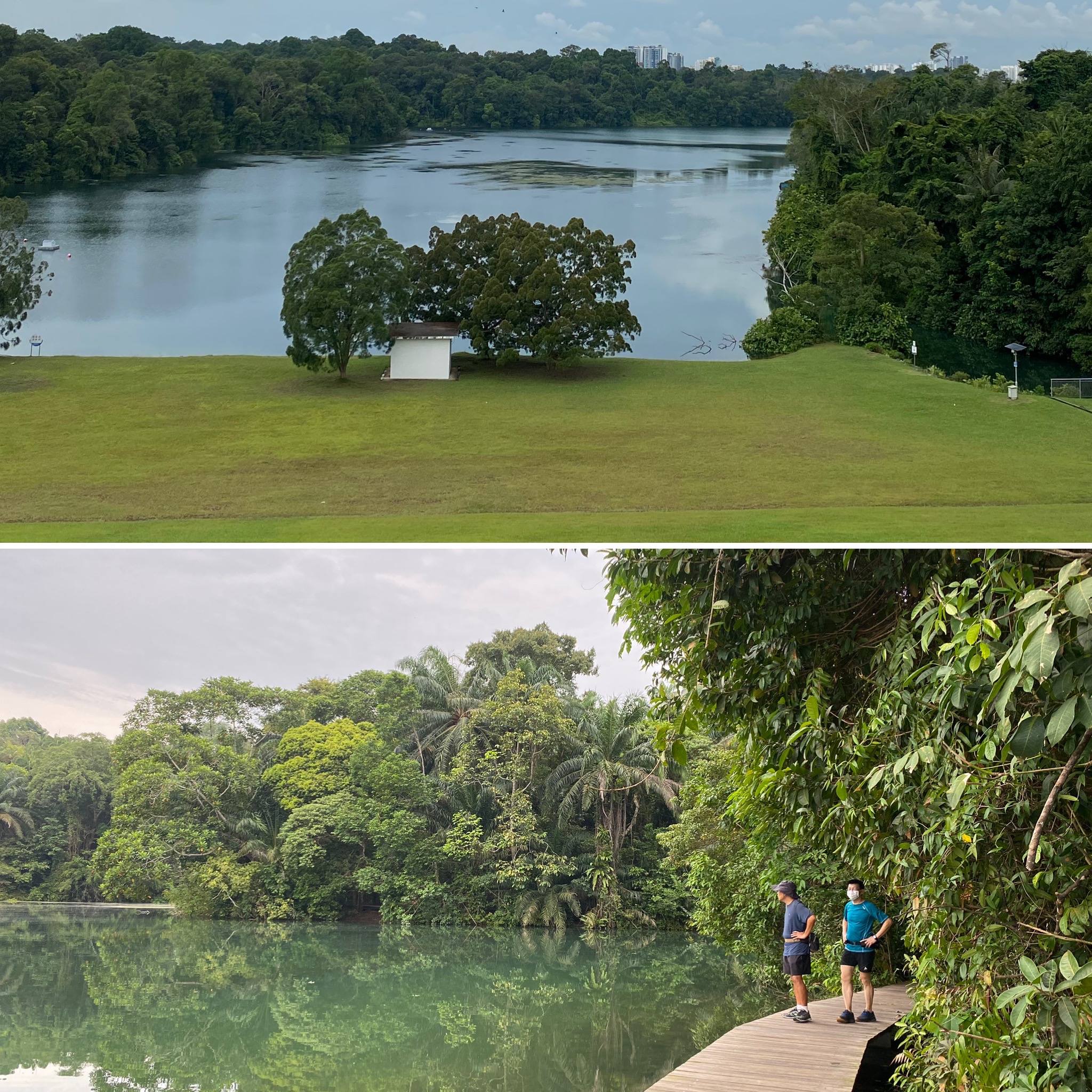
(1) Southern Ridges - Hort Park - Labrador Park - Rail Corridor
Date: 3rd October
Start: Harbourfront MRT, 7 p.m
End: Commonwealth MRT, Commonwealth Drive Hawker Centre, ~1 p.m
Distance: 17.25km

SEPTEMBER
Upper Thomson - Bishan (September 26, ~16km)
Start: Yio Chu Kang MRT, 3:30 pm
End: Bishan MRT, ~7:30pm
Distance: ~15.5 km
Distance: ~15.5 km
(Photos : Courtesy of fellow walkers)

We walked along Upper Peirce Reservoir Road as there was no pedestrian path, so we shared the road with vehicles, bicycles and the occasional monkey. It could be worthwhile to build a pedestrian path here - it's a nice road to walk along!

Apparently, the natural inhabitants of this "settlement" have become over-populated?

Even the camcorder needs protection from the monkeys?

From afar, one can see Lower Peirce Reservoir. Since there is no designated trail to walk there from Upper Peirce Reservoir, we retraced our steps back to Upper Pierce Road to walk to Lower Pierce Reservoir.
"Wow Pretty, maybe it resembles Jiuzhaiguo?"
"Probably "Yizhaiguo" ? 😄
[Jiuzhaigou - "Nine Settlement Valley" takes it name from the nine Tibetan settlements along its length. Lower Pierce Reservoir has only one local settlement? 😉]

We proceeded from there towards Bishan Park. On the way, we saw a sign about possible wild boar sighting... was there one such signage in Chestnut Nature Park?
OK: "Take a photo and send to YC".

 Thanks OK + WS for queuing and buying dinner. A good walk with equally good company and food.

After walking through Bishan Park, OK walked ahead of us towards Bishan Bus Interchange Hawker Centre to queue for the Shi Xiang Ge La Mian Shaved Noodle Bishan noodle. 😋

AUGUST
Chestnut Nature Park - Diary Farm - Upper Bukit Timah Road
Start: Bukit Panjang MRT, 3 pm, 16 Aug 2020
End: Beauty World MRT, ~7:30pm
Distance: ~ 13.24 km
End: Beauty World MRT, ~7:30pm
Distance: ~ 13.24 km
(Photos : Courtesy of fellow walkers)
It had been raining but no one suggested postponing the walk. Thus, we met at Bukit Panjang MRT and started our walk in the rain, heading towards Chestnut Nature Park. [overwhelming enthusiasm or not to be the spoilsport?!] 😉

I did not know that Chestnut Nature Park is the largest nature park in Singapore (as of now), and it comprises a North and South area. Although the ground was muddy, it was refreshing to walk within a nature reserve.

After walking for about half hour, we came upon the Observation Tower. A few of us climbed up the tower for a view of the surrounding landscape.

We continued walking, and chanced upon a wild boar (with its piglet?). Although the others were excited to take photos of it, I gave it a wide berth (Not keen to be attacked by it - 😅).
We arrived at the small carpark with a bike rental shop, and took our break there [Thanks HP for the soft drinks! :)]
By this point, I felt that we had walked a lot, but it seemed like we missed walking one area (North or South?) of the park. Once again, we entered the forest to cover the other north/south part.
[Shall I participate more actively in plotting the route in the future? ... maybe not]😑

The forest landscape was rather indistinguishable to me. Still, when the photographer of our group was within sight, I would follow his photographic gaze and discover wildlife that I'd miss in my own view of the forest around us.
Unfortunately, some way into the walk, he fell when out of sight, and bruised his elbow and palm (trying to save his camera?).
[Realised that we were ill-equipped to handle minor injury/cuts]. 😓

Nevertheless, we completed our walk through the north and South of Chestnut Nature Reserve, walked Zhongshan Park and ended our walk at Hillview MRT bus stop. We were undecided about where to have our dinner, and YC started walking towards Beauty World.
[Oh, the walk has not ended, either the distance covered was too short or there is better food selection at Beauty World ?] 😵
Although it was tiring to continue walking after a rather prolonged rest at the bus stop, the sky had cleared and the air was good for walking.
It was definitely a memorable experience to have walked despite the rain, discovering Singapore's largest Nature Park, and ending at the MRT nearer to my place. 😈
We also had a good dinner, and it was a good walk with good company. 😍
Lorong Halus Wetland - Pasir Ris Park (Aug 8, ~16.1km)
Start: Punggol Waterway MRT, 3 pm
End: Changi Village, ~7:30pm
Distance: ~16 km
End: Changi Village, ~7:30pm
Distance: ~16 km
(Photos : Courtesy of fellow walkers)
The weather was very hot and humid when we started our walk from Punggol Waterway, where we proceeded along Punggol Park, Lorong Halus Wetland, Pasir Ris Beach, Pasir Ris Park, Loyang Avenue and ended off at Changi Village.

A particular red bridge linking Lorong Halus Wetland to Pasir Ris Beach struck me as being quite photograph-able, which seemed to be a sentiment shared by the other walkers, given the numbers of photos taken of it.

Personally, I was also pleasantly surprised to have spotted hornbills while in Pasir Ris Park.

I'd brought along a packet of Himalayan Salt mints, which, even in their packaging, seemed to have melted a little under the sweltering heat. Still, I gladly ate the mints along the way as a source of energy, given how tough the heat was making the walk. Luckily. the pack of mints was just enough to share among the walkers... except the leader cum photographer who was too far ahead...
Along the way, HP and Sally exited the walk and took a taxi to Changi Village ahead of us. Thanks to them, once we finally reached our destination, we were able to have our dinner without queuing for a table at Andes by Astons
It was a good but tiring walk.
Labrador Park - Southern Ridge - Vivo (15/8, ~11.3 km)
Start: Labrador Park MRT
End: Vivocity
Distance: 11.31 km
Photos: Courtesy of the walking group members
After many text messages to decide on the walking route, we fell back on our default route - part of the Southern-Ridge walk.


After walking through Labrador Park, we walked along Pasir Panjang Road, climbing up Pepys Road. Although I frequent the prawn noodle stall at Pepys Road's coffeeshop, it was the first time I walked to the top of the road.
[During WWII, the hill at the end of Pepys Road was one of the last battles (the Battle for Pasir Panjang) that Singapore fought against the invading Japanese Army.]

From the top of the road, we walked the Southern Ridges' Canopy Park, Hort Park, Alexandra Arch and Telok Blangah Hill before arriving in Vivocity.
There was a long queue to get into Vivocity, and we decided to ask Sally to cancel the dinner reservation... just as the queue suddenly moved very quickly, and we back-pedaled immediately, quickly asking Sally to un-cancel the dinner reservation.

Luckily, the reservation was good, and we had a scrumptious dinner to cap off the day (Thanks WS+YC)! We walked ~11km, expending ~700 calories.
[An 'imbalance' in calories between intake and exercise?] 😮
Overall, it was a good walk, and it was nice to finally trek up Pepys Road having been there many times without doing so.
----------------------------------------------------------------------
* There were so many gorgeous and very professional-looking photographs taken by the walking kakis! 😍
As I browsed through these photos, the photo of the colourful steps we had encountered (somewhere near Labrador Park?) reminded me of Jinhae Owl's Stairs and the leaves (near Telok Blangah Hill?) brought back thoughts of Seorak's Autumn in South Korea.

The walk has enable me to know more of Singapore's interesting history, and its yet-to-be-discover attraction 😎, and to recall fond memories of past travels... 💓
(II) July Walk - West Coast Together Plan
Start: Clementi MRT, 3:30pm, 31 Jul 20
End: Tanglin Mall, ~7:30pm
Distance: 13.86km + 1.1km = 14.96km
Dinner : Tanglin Mall Food Court
(Map/Photo : Courtesy of YC/HP/STLT)

~ Instead of having our next walk in August, we decided to take a second walk in July 👍.
~ Coffee break at West Coast Plaza's Toastbox
~ Yummy snacks in additional to dinner : Thai chicken wings, spring roll, prawn cakes, fried bean curds and Xiao Long Bao (😋, Thanks)
~ The East Coast walk was more pleasant than the West Coast walk?
(I) July Walk - East Coast Plan
Start: Paya Lebar MRT, 5pm, 11 Jul
End: Bedok South, 9pm
Distance: 13.06 km
Late Dinner : TzeChar at Coffeeshop. (YC, Thanks!)
(Map/Photo : courtesy of YC and HP)

~ Morning Text about walking, and confirmed walk at 5pm ~ swift action/decision 👍
~ Pleasant evening walk in the East.
~ Social distancing - ordered White beehoon, spinach with eggs (?), fried baby squid, honey pork ribs (uncle table only)
# While in cab - "Aiyo, how come we did not think about sharing cab with YC? Why did he cross the road??"
End: Tanglin Mall, ~7:30pm
Distance: 13.86km + 1.1km = 14.96km
Dinner : Tanglin Mall Food Court
(Map/Photo : Courtesy of YC/HP/STLT)
~ Instead of having our next walk in August, we decided to take a second walk in July 👍.
~ Coffee break at West Coast Plaza's Toastbox
~ Yummy snacks in additional to dinner : Thai chicken wings, spring roll, prawn cakes, fried bean curds and Xiao Long Bao (😋, Thanks)
~ The East Coast walk was more pleasant than the West Coast walk?
(I) July Walk - East Coast Plan
Start: Paya Lebar MRT, 5pm, 11 Jul
End: Bedok South, 9pm
Distance: 13.06 km
Late Dinner : TzeChar at Coffeeshop. (YC, Thanks!)
(Map/Photo : courtesy of YC and HP)
~ Morning Text about walking, and confirmed walk at 5pm ~ swift action/decision 👍
~ Pleasant evening walk in the East.
~ Social distancing - ordered White beehoon, spinach with eggs (?), fried baby squid, honey pork ribs (uncle table only)
# While in cab - "Aiyo, how come we did not think about sharing cab with YC? Why did he cross the road??"
June (Raffles Place - Marina Square)
Start: Raffles Place, 9:30 am, 27 Jun 20
End: Marina Square, 11:45 am
Distance: 13.51 km
Highlight:
Lunch: Redpan, Western fusion. (WS, Thanks!)
Coffee/Tea: Ah Kun (HL, Thanks!)
(Map/Photo : courtesy of YC)

A good catch-up after circuit breaker. 😊
May (Circuit Breaker)
No Walking: Circuit breaker
April (Raffles Place - Vivo)
Start: Raffles Place
End: Vivo
Distance: 14.5 km
Highlight:
Delivery of Ah Kun breakfast and more. THANKS!
Teochew lunch at Vivo. (OK, Thanks!)


March
Start: MacRitchie / Toa Payoh
End: Toa Payoh / Kallang
Distance: 12.5 km
Highlight:
They had a sumptuous meal (without me)...


Start: MacRitchie / Toa Payoh
End: Toa Payoh / Kallang
Distance: 12.5 km
Highlight:
They had a sumptuous meal (without me)...


Feburary
To each his/her own
January (Vivo - Merlion)
Walkers : HL, HP, OK, PL, WS, YC
Starting Point : Vivo, in front of Tangs
Ending Point: Merlion
Distance: 15.84km
(Map: courtesy of YC)
We started punctually, led by our pace leader YC. We walked from Vivo, towards the boardwalk in front of the Caribbean Condo at Keppel Bay, then to the Marina, Keppel Club and Labrador Park. At ARC, we decided to skip Holt Park, and walked to Telok Blangah Hill before having our first break and rest stop.

We walked along the Alexandra PCN towards Zion Hawker Centre for a drink break.
Then, we walked 'stylishly' (trying best to look sporty and effortless in our walk) along Robertson Quay, without being tempted by any of the eateries and cafes along the river front.
It started raining when we reached Victoria Theatre. Although, we made our best efforts to continue walking, we decided to stop our walk at MBS.

Ending Point : MBS, Blossom Restaurant 😃
We had our first LoHei for 2020 (except YC who already had one the day before)!

I enjoyed the walk thoroughly despite not hitting our 20km target.
Next Walk: 8 February, 2:30pm ?
Starting Point : Punggol Waterpoint (overheard that there are a few Tangs entrances... got to be more precise with the meeting point ;))
Ending Point : ???
[For future walks :Defu Yummy Palace (Chicken within pig stomach Soup)]
Target Distance : more than 15km
Route Planner : YC (Much Thanks in advance!)
Planning parameters :
(1) Minimal 'facing the sun' direction (PL request)
(2) Flattish terrain (HP request)
(3) Defu area is dark and quiet, not ending too late (being mentioned)?
(4) Only if I can pay for Route Planner’s dinner
Walking in Singapore 2020
References
Nparks - Part Connector Network
Nparks - Rail Corridor

Our First Walk
Let's Take a Walk 2019 - A 12 hours walk with Friends
To each his/her own
January (Vivo - Merlion)
Walkers : HL, HP, OK, PL, WS, YC
Starting Point : Vivo, in front of Tangs
Ending Point: Merlion
Distance: 15.84km
(Map: courtesy of YC)

We started punctually, led by our pace leader YC. We walked from Vivo, towards the boardwalk in front of the Caribbean Condo at Keppel Bay, then to the Marina, Keppel Club and Labrador Park. At ARC, we decided to skip Holt Park, and walked to Telok Blangah Hill before having our first break and rest stop.

We walked along the Alexandra PCN towards Zion Hawker Centre for a drink break.
Then, we walked 'stylishly' (trying best to look sporty and effortless in our walk) along Robertson Quay, without being tempted by any of the eateries and cafes along the river front.
It started raining when we reached Victoria Theatre. Although, we made our best efforts to continue walking, we decided to stop our walk at MBS.

Ending Point : MBS, Blossom Restaurant 😃
We had our first LoHei for 2020 (except YC who already had one the day before)!

I enjoyed the walk thoroughly despite not hitting our 20km target.
Next Walk: 8 February, 2:30pm ?
Starting Point : Punggol Waterpoint (overheard that there are a few Tangs entrances... got to be more precise with the meeting point ;))
Ending Point : ???
[For future walks :Defu Yummy Palace (Chicken within pig stomach Soup)]
Target Distance : more than 15km
Route Planner : YC (Much Thanks in advance!)
Planning parameters :
(1) Minimal 'facing the sun' direction (PL request)
(2) Flattish terrain (HP request)
(3) Defu area is dark and quiet, not ending too late (being mentioned)?
(4) Only if I can pay for Route Planner’s dinner
Walking in Singapore 2020

References
Nparks - Part Connector Network
Nparks - Rail Corridor

Let's Take a Walk 2019 - A 12 hours walk with Friends